This past May, Adam and I took our first trip to Western Australia. It was such a unique experience that I doubt either one of us will every forget it. We flew into Broome and for 12 days traveled all through a part of Australia called The Kimberley's. You can read about our amazing trip HERE, HERE and HERE.
This very special area in north western Australia also happens to be one
of the largest holders of gas, coal, uranium and bauxite reserves in
the world. Just since our trip, the Western Australian
Government and Woodside have been trying to land
an industrial hub here in order to turn natural gas into liquid
gold and LNG.
The gas hub, located at James Price Point near
Broome, is opposed by local residents as well as Aboriginal groups, as
it will be built over ancient cultural
sites. There is also concern it will impact endangered species, such as
the breeding and migration zones of humpback whales.
This is only a small part of the big problem. Obviously, we do not support any gas hub or drilling off the coast of Broome. As Americans, we know what dangers lie ahead.
Please help stop this from happening by clicking HERE and to find ways to help. If nothing else, please just pass this along so that together we can help educate others and hopefully, stop this from happening.
Thank you!
Showing posts with label the Kimbereleys. Show all posts
Wednesday, November 14, 2012
Tuesday, May 29, 2012
The Kimberley in Ten Days: Part III
For Part I, go here.
For Part II, go here.
Thursday we
continued backtracking and drove from Halls Creek to Fitzroy Crossing. This
drive was slowed -- just a bit -- because we'd pull over to check on other
travellers stopped on the side of the road.
About 30
kms past Fitzroy Crossing we left the blacktop and turned north on the Leopold
Downs Road, a dirt and gravel road that was in good condition for the most part
but whose bad sections seemed they might rattle the Pajero to pieces.
After an
hour along this road we came to a huge water hazard. A pond basically sat in
the road. On one side, trees prevented circumventing it and on the other the
pond emptied into a creek. Shit.
I got out
of the car and walked into the pond to see how deep it was. It was only halfway
up my calves but the bottom was very soft and muddy. I worried about the truck
just sinking in the mud to the point that it got stuck. There were also a few
big rocks that might trip us up. Whereas other roads had at least had the
occasional traveller, we hadn't passed anyone, so if we got stuck we could be
waiting a very long time for help.
If I went
around towards the creek side, I'd be able to keep one side of the truck mostly
out of the water, but couldn't see what was below all the soggy grass (and I
was still paranoid about puncturing another tire). I decided to do it anyways
and slowly churned across; the passenger side was firmly in the pond and the
car was at a 45 degree angle. Sharon could have stuck her hand out the window
and scooped up the water. But we made it. Safely across, we rumbled to our
first stop, Tunnel Creek.
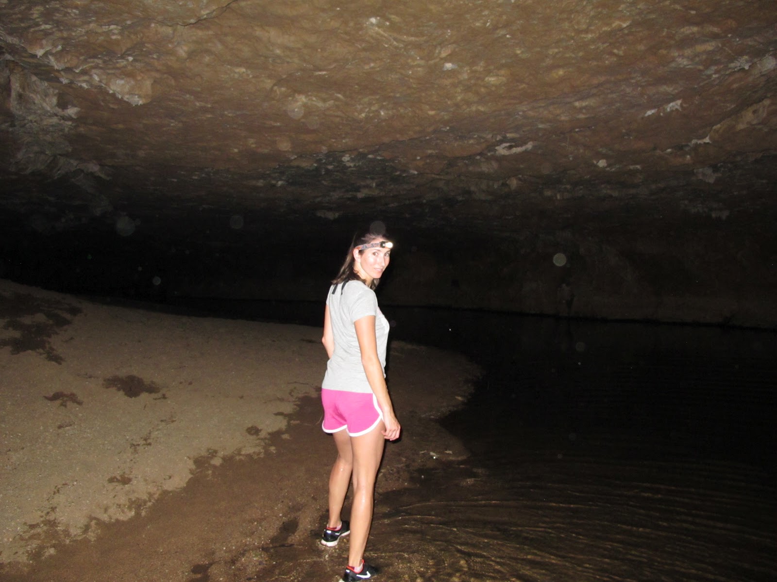
Tunnel
Creek, as the name suggests, is a large cavern formed by a creek cutting
through cliffs (yet another remnant of the Devonian Reef). To enter, you walk
from the parking lot down a short trail to the creek and crawl over a number of
quartz boulders. It gets pitch black quickly, so you need a flashlight. The
hand-held kind (mine) worked better than the kind that strap to your melon
(Sharon's).
| The way into Tunnel Creek. |
| A bit of light enters midway through. |
| An internal waterfall. |
| The ceiling. |
| Welcome to the other side. |
Our
flashlights illuminated fish, crayfish, tiny frogs, and bats in the darkness.
The tunnel is probably half a kilometer long. We had to wade through the water at several
points, but it was never deeper than mid-thigh. The tunnel terminates on the
far side of the cliff and we were greeted with a beautiful scene of the creek
widening out, flanked on both sides by trees. We hung out for a bit before
going back through the tunnel.
| The view on the far side of the tunnel. |
As we
returned to Leopold Downs road to head on to Windjana Gorge, our campground for
the night, we passed a sign that had amused me. It simply said "Dip"
and warned against a dip in the road ahead. We passed several of these
"Dip" signs. I would see them and think, "Dips? Seriously? What
about the ten other dips and multiple water hazards there weren't any signs
for? Why even both to put any signs up since the whole road is a mess?"
We also saw
a curious result of the controlled fires. One side of the road would be a lush
green and the other would be blackened from fire, the trees' leaves cooked to
an orange-brown. It was like the road straddled two worlds.
In late
afternoon we arrived at Windjana Gorge and set up camp. This campground was
more open, and more crowded, than the campground in Purnululu, though half the
spots were still free. It also thankfully had showers and toilets with running
water (and the showers even had hot water!). We made chicken schnitzel and
baked beans and sipped on our expensive beers while the evening cooled a bit.
Fire was permitted in this park and a few campers started roaring bonfires.
When it got dark we climbed into the tent to read a bit, free from the
mosquitoes, and went to sleep early.
Friday
morning we walked to Windjana Gorge, known for hosting up to 80 freshwater
crocodiles. Freshies, as they're called, generally don't get any larger than 3
meters and aren't considered a menace to
humans unless provoked. The crocs were the key attraction for me and I was
pretty bummed that we didn't see any when we started our hike through the gorge
around 8:00am. But by the time we were on our way back we saw about a dozen
lounging on the opposite bank.
| Windjana Gorge. |
| Freshie. |
After
Windjana, our plan was to go to Bell Gorge, which is supposed to be among the
most beautiful gorges along the Gibb River Road (which has tons of gorges). Unfortunately this was closed
for some reason so we decided to skip ahead to the next stop, Manning Gorge. We
spent a final half hour on the Leopold Downs Road before turning north on the
Gibb. Initially it was paved, which got me excited that it would be a smooth
ride. That was naïve, though, because it quickly gave way to the standard
packed gravel and dirt. Still, it was in the best condition of the offroad
roads we'd been on. But like the others it had its rough parts that just
hammered the miles in.
| Queen Elizabeth's Head on the right, seen driving north on the Gibb. |
Along the
road we saw our first wild dingo. It was snacking on a kangaroo killed by a
truck and flew off into the woods as we approached. We saw another dingo a
short time later. Cows once again roamed in front of us and a quick horn blast
dispersed them.
![]() |
| Our first wild dingo. |
From
Windjana to Manning was a three hour drive. We had to stop at a roadhouse near
the entrance to pay the camping fee and also bought an extra bag of ice, which
cost $10.50. Supplies in this part of the world are hard to get and are pretty
expensive as a result. The campground was mostly empty, so we picked a spot way
from others, made lunch, and then went to explore the gorge.
To get to
the gorge you first have to cross a wide stream. There are styro-foam boxes so
you can float your stuff across, but there's no avoiding getting in the water.
The setting is paradise, though. Tall palms and eucalypts border the water. A
large rock provides a resting point midway. If this was the destination we
would have been quite content to swim around and soak in the view. But really
this is just the starting point to the gorge. Sharon and I thought it was quick
hike so were wearing bathing suits and flips flops. In reality, it's a very
rocky trail. Even the term "trail" is being a bit generous, since
really it was just hills and hills of large rocks, with the occasional white
dot painted on one to indicate you're still going the right direction. It took
us a good 45 minutes to get to the end and one more than one occasion we
wondered if this was a big joke and we were the suckers.
| The start of the trail to Manning Gorge. |
| Sharon wades across. |
| Can you find the trail? |
| We made it! |
| My goanna. |
All the
hard work was worthwhile as soon as we caught a glimpse of the gorge, though.
Manning Gorge was my favorite spot on our trip and I could have spent the
entire day there. A wide waterfall poured into a large pool perfect for
swimming. The stream continued on to other swimming pools, bordered by
sandstone cliffs and plants. I found a goanna and snuck up to take a close-up
photo (I later learned this is a bad idea as they can run up your body with
their razor sharp claws). Sharon and I soaked in the atmosphere for an hour and
a half or so, and then had to head back before it got dark. Even in the
daylight we lost the trail a couple times, so navigating in the dark would be
impossible.
On our way
back across the stream, we saw an old man on the far side; he could have passed
for Father Time with his white beard. He was wearing mechanic's overalls with a
bottle of beer tucked firmly in each breast pocket. He plunged into the water
and swam to the rock in the middle, where his wife was already waiting,
dripping wet in her full set of clothes. They cracked open the beers and soaked
up the sun on the rock. You meet a lot of characters on the Gibb.
While we
were setting up dinner three tour buses rolled in. Each discharged 25 or so
people and it hinted at how much more populous the campgrounds would be when
the tourism high season arrived in June. Most of the tour bus passengers were
in the 50s or 60s, with some even older. We watched many limp their way to the
bathrooms. How on earth were they going to hike to Manning Gorge, we wondered.
| If you don't want to do the trip yourself, this is what you'll travel around in. In the wet season they're used to transport miners. |
Manning
Gorge was our northernmost point on the Gibb River Road. After Manning the
tourist sites are fewer and there isn't any place to refill your gas tank until
you hit Kununurra, about 350 kms northeast. There were other sites back down
the road in the direction we were heading, but many of these were a good
distance off of the road down their own rickety tracks. So because Bell's Gorge
was closed we decided to make one final stop at another famous gorge and then
head back to Broome. Instead of spending our Sunday driving, we'd be able to
spend it lounging on the beach.
Galvans
Gorge was only about 30 minutes south of Manning Gorge, and is one of the
easiest to access. A one kilometer walk takes you to a waterfall plunging in to
a small swimming pool. The waterfall cascades down a few levels with a giant
boab tree on top overseeing everything. We were there early -- about 8:00am --
and had the place to ourselves for a short time before another 25 people
arrived. The heat of the day hadn't penetrated the tree cover to warm the day
yet, but we swam around and hung out under the waterfall anyways.
| Galvans Gorge. |
We were
back on the road by 10:30 and headed to Broome via Derby. There isn't much to
see in Derby apart from the famous Boab Prison Tree. Boabs have fat trunks that
taper at the top -- they're also referred to as bottle trees -- and the bigger
ones are suspected of being thousands of years old. There's no way to tell as
they don't have tree rings, however. The oldest, and hence the biggest, were
occasionally used as temporary prisons. The settlers would hollow them out and
stick aborigines in them.
This
particular prison tree in Derby was used as a holding cell for young aboriginal
men who'd been kidnapped by settlers to do forced labor for the pearlers in
Broome. The white pastoralists went along with this and often aided in the
kidnapping because they thought if the aboriginal communities lost all their
young men, the communities would be docile (it didn't work). Many old Boabs
also featured in aboriginal religious belief and the Derby prison tree was
among these, so was fenced off.
When we got
back to Broome we had mobile phone service again. I instinctively got out my
phone to check email and Facebook, but stopped and put it away again. I wasn't
ready to be connected. Sharon and I joked about how hard it would be to adjust
back to the hubbub of Sydney.
Since we
were back in Broome a day early we didn't have anywhere to stay. We found a
caravan park overlooking the water that allowed campers and picked up a spot.
But whereas the Kimberley got quite chilly at night, Broome stayed sweltering.
I opened the tent flap a tiny bit to let in some of the sea breeze in the hopes
that it would cool down enough for us to sleep. I dozed a bit but jolted awake
at the telltale sound of buzzing. Mozzies had breached the castle walls! Sharon
and I spent the next half hour killing all the mosquitoes in the tent. The
paper towels we used were spotted with blood (our blood!) and Sharon's skin
showed their handiwork in the morning.
I was
grateful when daylight arrived. We packed up camp, ate breakfast overlooking
the ocean, and returned the camping equipment we rented. Since the truck was coated inside and out in the
fine red dust from the road I also decided, in the interest of avoiding
Europcar's cleaning fee, to take it to a carwash. We spent a couple hours at
the beach and then headed to our accommodation for the night, the Lord McAlpine
House.
This house
was initially the home of a prominent pearler and was purchased in the 90s by a
British politician, Lord McAlpine, who expanded it and used it as his home when
he visited Broome. The home was subsequently sold and turned into a boutique
hotel. I figured we'd want somewhere nice to decompress after camping and this
place was perfect. It only had eight rooms so was very quiet. Lush gardens
(with over 100 species of native plants) shut out the world around the
property. Sharon and I sat next to the pool and read all afternoon. It was a
nice way to end the trip and I would have been happy to spend another day just
lazing around there. But alas, all trips come to an end so Monday we waved
goodbye to Broome and flew back to Sydney.
| Veranda of original house at Lord McAlpine House. |
| View of the parrot houses. |
| Communal breakfast table. |
| One of the amazing trees at Lord McAlpine house and one of Adam's Top Ten Trees of All Time. |
Sharon had
never camped in her life and I hadn't gone camping for probably fifteen years
or so. This trip certainly didn't make us into serious campers, but it was fun
and Sharon embraced it. I told her, "You're a good adventurer, Sharon. And
no matter how much trouble I get us in you're always game for more."
Oh, and
that tire? $287 to replace. Ouch.
Things to consider and advice if you go:
Timing
Peak
tourist season is June-August. The earlier in the season you go, the greener
and wetter things still are. It's supposedly pretty dried out and dusty by
August. Most of the roads open in April but that's still a pretty risky month. We went May 5-14. Everything was still lush and the waterfalls were
very impressive (they dry up too), but the roads were pretty rough. We saw
workers grading every road we were on: the Mabel Downs track,
Leopold Downs, and the Gibb. Also, it's possible the road to Bell Gorge would
have been open if we'd gone
later (although nothing is ever a guarantee out here). So a couple weeks later in the season we would have had a smoother ride and been able to see everything we
wanted. On the other hand, you'd be sharing the sites with more tourists. And
in June, some campgrounds get completely full and you can't enter until someone
leaves.
Tire check
I never
would have thought of this until it
happened to us, but if you have a rental truck make sure you can loosen
the wheel nuts with the spanner wrench that comes in the rental. Flat tires are
a fairly common experience on the tracks (we met one group who'd had three). If
you can't loosen it find a mechanic who can do it for you, and then tighten
them yourself using your own strength. That way you'll know you'll be able to
take them off if needed. You should also carry a tire gauge so you can measure
your tire pressure -- you need to lower the pressure when you go offroad to decrease the risk of a puncture.
Prep time on either side of your trip
I recommend
leaving yourself at least one full day on either side of your trip for prep and
clean-up -- getting gear and food, figuring out to pack the truck the best way,
and cleaning all that dirt off at the end. Plus, if you have a truck issue and get delayed, you won't have to worry too much about missing your flight home.
Planning your trip
This
website (http://www.kimberleyaustralia.com/)
is useful but I highly recommend purchasing the site's PDF guide to the Kimberley. It
has a huge amount of good information on sites, itineraries, and other things
you'll need to plan.
Sunday, May 27, 2012
The Kimberley in Ten Days: Part II
For Part I,
go here.
The next
morning we got up early, wolfed down some oatmeal in the hotel room, and were
out the door by 8:00 to head to Purnululu National Park. Sharon was doing the
driving to the park and then I would take over to handle the off-road trail. As
usual, the highway was mostly empty, though it had a bit more traffic than the
leg from Broome to Halls Creek.
Along the
way a big hawk lazily swooped in front of us. A little too lazily. Like
seriously, bird, get the hell out of the -- whump!! The hawk ploughed into the
bull bar and then tumbled up over the hood to smack the windshield, where the
wind peeled it off and tossed it to the side of the road.
Whereas I
had been personally responsible for the fate of the crow, now that Sharon was
doing the damage it was the bird's fault. "There's nothing around for
miles and he has to hit my car? These birds are so stupid!" she yelled
incredulously.
Two birds
in two days. At this rate we'd kill an entire flock by the end of the trip.
| Besides taking out birds, we killed our fair share of bugs. This is what the windshield looked like after a few days. These are all bug splatters. |
The
distance from Halls Creek to the trail heading into Purnululu was 180 kms, which we covered in about an
hour and a half. The trail to the park was roughly 50 kms. This distance alone
took us another couple hours to navigate. The trail cuts through a giant cattle
station called Mabel Downs; the staff maintain it for tourists and for their
own use, but it's by no means a smooth ride. The trail at its best is
corrugated gravel but is interrupted by steep inclines, hairpin turns, creek crossings, mud, and
large rocks.
The first
creek crossing was several truck lengths in distance and I wasn't sure how deep
it would go. I was mindful of the rental car policy that we shouldn't drive in
anything that was deeper than halfway up the tire. I wasn't about to turn
around at this point, however, and operating under the assumption that if other
people had made it through, we could too, we eased in. This was the first of many creek crossings,
all of which proved to be shorter (though not necessarily shallower).
![]() |
| Creek crossing numero uno. |
Once we
arrived in the park, the road conditions improved a bit. We checked in with the
visitor center and drove to our campsite, pulled into our designated spot, and
parked to make some lunch and set up some gear.
As we had
bounced and jostled up and down the hills of the trail towards the park we
smelled gasoline in the truck. We had a 20 liter jerry can in the back so that
was no doubt the source of the smell. We had opened the windows to air it out
but never thought to stop to investigate. While I don't recall consciously
having this thought, I'm sure a part of my brain rationalized the smell by
thinking: "The ambient temperature in the car is rising, which would make
the gasoline molecules become more active and expand, so of course you'd be
smelling gasoline. That's science. God, you're an intelligent man, Adam."
Unfortunately,
it turns out I am not.
Upon
opening the back door, we discovered that probably a good liter of gasoline had
leaked out of a loose cap and coated the cargo area and a number of our things.
We wiped up what we could with the paper towels we had and cursed ourselves for
not stopping to check the smell out early on.
We made a
quick lunch and then drove another thirty minutes to see the Bungle Bungle
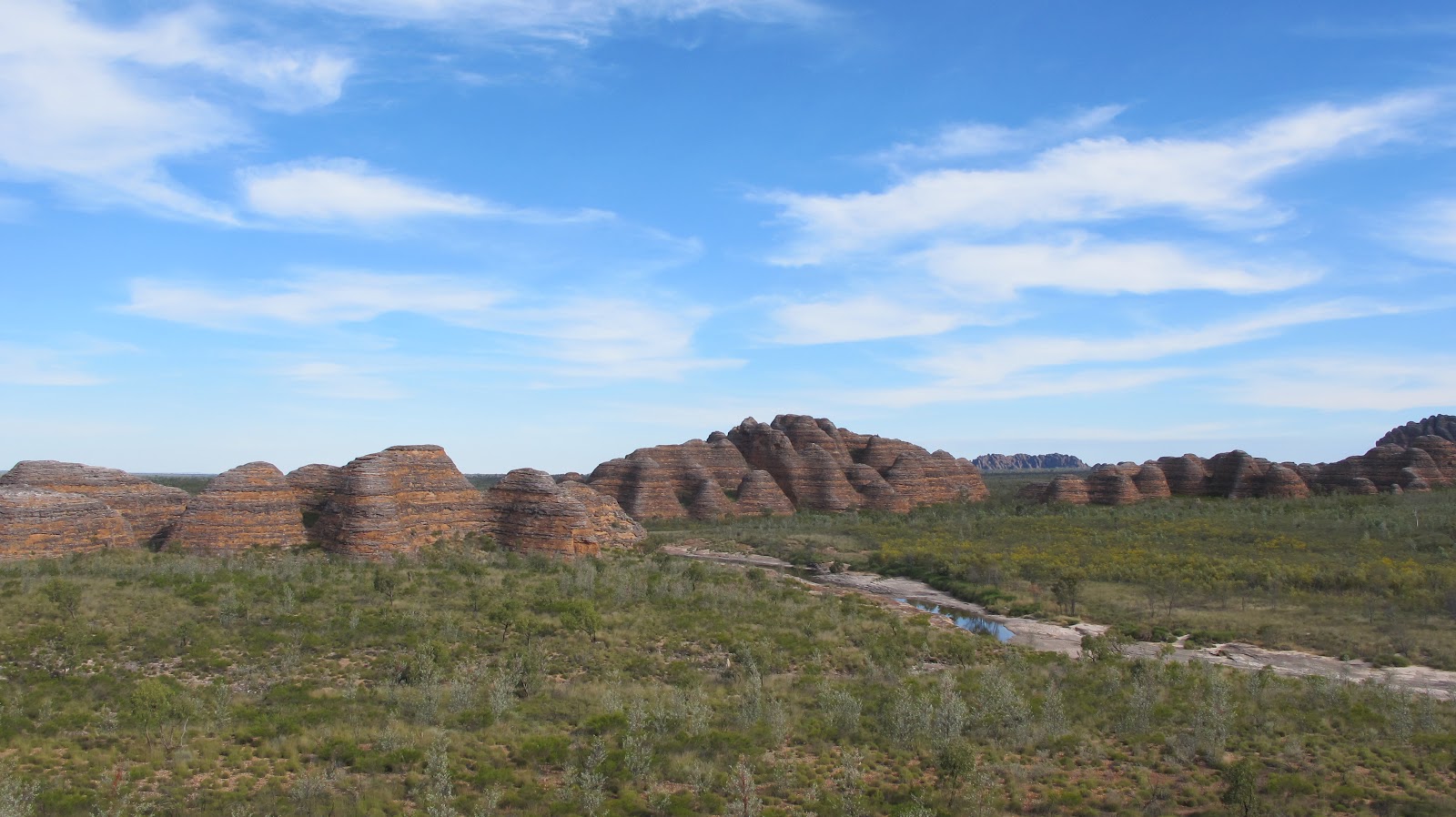
Range. The Bungle Bungle Range, or the Bungles for short, are probably the
prime attraction in the Kimberley. They are a huge collection of beehive-shaped
domes of alternating orange and grey sandstone. I suppressed any concerns of
the car overheating and igniting the gasoline and we made the short hike into
the park.
| The Bungles. |
The Bungles
weren't my favorite stop on our trip, but they certainly were the most awe-inspiring.
Hundreds and hundreds of domed peaks rose around us. Sharon took this video right at the trail head:
We followed the trail to a
spot called Cathedral Gorge, where a huge cavern had been carved out of the
rock face.
| Hiking into Cathedral Gorge -- check out the orange on that cliff! |
| The Cathedral end of Cathedral Gorge. |
We followed the trail back to a junction and headed off to Picaninny
Creek. The dry creak bed was solid rock, and had these incredible, deep grooves in
it from the wet season's torrents of water. About a hundred meters up the creek
bed the creek still had water. Further on it begins to wind its way through the
Bungles. With permission from the visitor center you can hike to the start of
the gorge and camp overnight. Sharon and I tried to walk up it as far as
possible but quickly ran out of dry land; on one side there were sheer cliffs
and on the other there was a gentle slope covered in razor sharp grass up to
our waists.
| Picanniny Creek. |
| The grooves cut in the creek bed. |
| Picanny creek heads into the Bungles |
| View from the lookout. |
We took
another 600m trail to a point overlooking a valley and some more domed rocks in
the distance and then hiked back to the
parking lot. The entire experience took about two hours; thankfully a wisp of
cloud muted the sun's heat, but we were still sweaty and dirty. Unfortunately,
our campground had no shower facilities so we wouldn't be cleaning up for a
while; the sanitary wipes we bought came up brown when we wiped down our faces
and necks.
I commented
to Sharon that if this were America there would be a two lane highway leading
right up to a vast blacktop parking lot and there would be a huge gift shop selling dome-shaped plush toys. There's something to be said for accessibility,
but also something to be said for making people put in an effort to experience a place like the Bungles. This was worth the haul.
Back at camp, we started
cooking our dinner around 5:00pm and quickly learned that it gets dark at 5:30. And by dark I mean pitch black. It was amazing how fast the daylight disappeared. The lanterns did what they could to cut through
the blackness, but we essentially cooked and ate in the dark (the lanterns also had the unfortunate side effect of attracting about a million bugs). Sharon was mostly
interested in the camp cuisine of others. Looking through some trees to our
nearest neighbor, Sharon opined that the woman we saw preparing her meal was
"probably like a professional camper."
| Sharon cooking dinner. |
There
wasn't much to do after dinner. Sharon asked, "What do camp people do
at night?"
"I
don't know," I replied. "Chit chat I guess."
We sat
there in the dark a while longer.
"Isn't
this fun?" I asked.
"This
is not fun."
With
nothing else to do, we climbed into the tent around 7:30 to go to sleep. A tour
bus had just pulled into a nearby camping area reserved for groups, and we
could hear them having a blast as the tour group staff set up camp and made
their dinner.
We fell
asleep to the carousing of our neighbors and the feint smell of gasoline.
I woke up
at 3:00am and thought someone had a spotlight on us; when I opened the tent
flap and walked outside I realized it was the moon. I'd never seen the moon
shine so brightly. I could literally have gone for a walk with no flashlight
and even thought about doing it, but figured I'd spook the few other campers.
* * *
On Wednesday morning we woke up
around 6:30am, made what would be our usual oatmeal breakfast, packed up camp,
and were on the road by 8:00am heading to the two other main sites in Purnululu:
Little Palm Grove and Echidna Chasm.
I crossed
one of the many creeks in the park and as we climbed the other side up we heard a loud hissing
sound. We immediately knew we'd punctured a tire. "Shit! Shit shit
shit!" I yelled. When I inspected the tire I saw that I'd punctured the
side wall, which couldn't be patched. "That's going to be an expensive
tire."
This was
karmic revenge for killing the two birds, I told Sharon. (Come to think of it,
Sharon also threw a rock at a termite mound).
We emptied
some things from the cargo area of the truck so I could access the jack. When I
lifted up the cover and grabbed the tools I discovered they were covered in
gasoline; our jerry can had leaked more than we thought and leaked into more
places than we thought.
I wiped off
the spanner wrench and went to loosen the nuts on the tire. They wouldn't
budge. I was using all my strength and they wouldn't move. I was actually
moving the truck but not the nuts.
Since everyone in the outback is, in a sense, part of an exclusive club of explorers, a code of the road applies: whenever you see someone pulled over, you slow down and ask them if everything is okay. I embraced this ethic wholeheartedly and was constantly checking in on people. "Code of the road," I'd say every time Sharon looked up from her book when I decelerated.
Fortunately, the code of the road applied in Purnululu. A few people passed and offered help; one older couple said they had a spanner wrench with a longer handle that might give me the leverage I needed. With the use of their wrench I was finally able to get the nuts loose, but it required so much effort I burst blood vessels in my palms from the pressure.
Since everyone in the outback is, in a sense, part of an exclusive club of explorers, a code of the road applies: whenever you see someone pulled over, you slow down and ask them if everything is okay. I embraced this ethic wholeheartedly and was constantly checking in on people. "Code of the road," I'd say every time Sharon looked up from her book when I decelerated.
Fortunately, the code of the road applied in Purnululu. A few people passed and offered help; one older couple said they had a spanner wrench with a longer handle that might give me the leverage I needed. With the use of their wrench I was finally able to get the nuts loose, but it required so much effort I burst blood vessels in my palms from the pressure.
By the time
I'd changed the tire we'd lost an hour. I was sweaty and covered in dust from
laying on the ground to place the jack. And the jack wouldn't go back down, so
if we had another flat we had one more spare but no means to put it on. I was
now paranoid about driving over any rocks, which wasn't a good thing in
Purnululu. But with the karma of the universe returned to balance, we climbed back in the truck and continued on our way.
Our next
stop was Little Palm Grove. The park had very subtle signage and I missed the turn off because I thought the road
was just a dry creek bed. Well, it was just a
dry creek bed but it was also the road. And it was made entirely from small
rocks. I eased along the path, just waiting for the tell-tale hiss of a burst
tire. We made it to the small parking area and started the hike, which at the beginning followed the same creek bed we'd driven along. There was no tree cover along
the creek so the sun was free to bake us to a crisp.
Thankfully
the trail soon wound up and into a gorge which provided much-needed shade. The
trail was the hardest yet -- we had to climb up and over rocks, squeeze between
boulders, and forge our way up steep hills. It finally came to a lush grove full of
palm trees. The little palms that give the grove its name are just young
versions of the adult tall palms.
| Pretty standard on the way to Little Palm Grove. |
From the
grove a stairwell led up to a small observation deck overlooking a patch of
virgin red soil. On either side cliffs rose up, tapering to a point where they
met and created a huge, pitch black cave. This was off limits to tourists but I
hopped the observation deck fence and climbed down the boulders to explore. A
large number of other footprints indicated I wasn't the first to do this. I
sprinted across the soil and into the cave with my flashlight out. I could hear
bats in the upper reaches but couldn't see them. I felt bad that Sharon was
still on the observation deck, so after a few minutes I clambered back up and
sweated our way back to the carpark. A placard at the start of the trail
estimated the hike took 2-3 hours; we did it in an hour and fifteen minutes.
| View from inside the cavern; way at the end of the dirt where you can see some boulders is where the observation deck is. |
| View from the observation deck. The cave at the far side is where I took the previous photo from. |
We jumped
back in the truck, eased our way back down the creek bed, and zoomed further
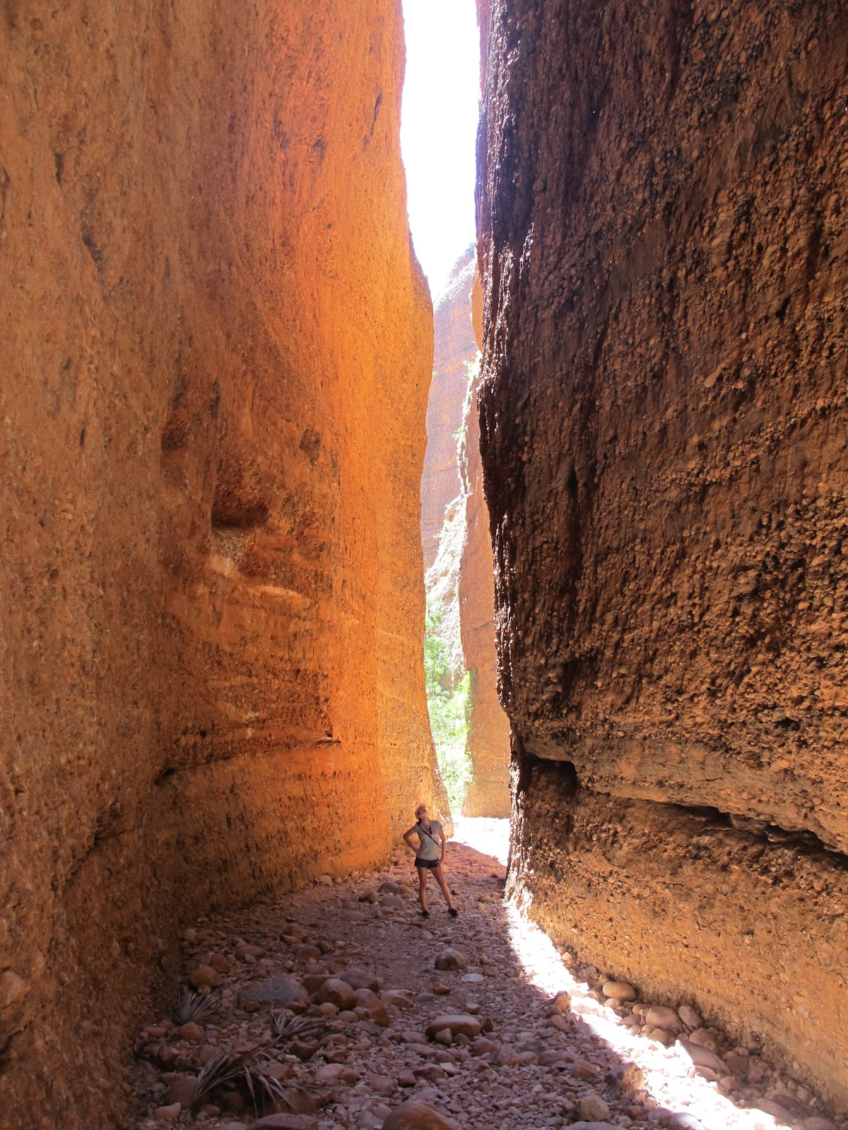
down the road to Echidna Chasm. This is, as the name implies, a rather large
chasm that is only illuminated
during midday when the sun is directly overhead (an echidna is one of Australia's many unique creatures and looks a
little bit like a porcupine with a long, slender nose; I have no idea how it gave the chasm its name). The chasm was a quick hike
from the parking lot and was cool and quiet.
By now it
was about 1:00pm and we were headed back to Halls Creek for the night. We left
the park and bounced and rattled our way back to the highway. Sharon gamely
tried to nap. At one point I got waved down by a passing truck. "Oh
no," I thought, "What now?" Turns out it was just our front
license plate falling off.
Even though
we'd only been camping one night, it felt great to get back to civilization.
Sharon threw a load of laundry in the machine at our hotel, once again the
Kimberley Hotel Halls Creek. I dumped a bunch of baking soda all over the back
of the car to help soak up the gasoline and neutralize the smell. We'd be
camping out the following three nights, so Sharon had the brilliant idea of
chopping up the veggies for our dinners now so she wouldn't have to do it at the
campsites.
When I came
in from cleaning the car as best I could I jumped in the shower to wash off the
grime of the previous two days. Something was partially blocking the drain and
when I picked it up I saw it was an onion skin. I also found a piece of onion
blocking the sink drain. These were the remnants of Sharon's prep work. It reminded me of the Seinfeld episode where Kramer
starts prepping all his food in the shower.
One thing you need when camping are some beers to enjoy at the end of each day. We had
forgotten to get get beer back in Broome and the lone, sad
looking liquor store in Hall Creek was empty except for two coolers full of a
suspicious-looking beer, so we picked up a six-pack from the hotel's sports
bar. Things increase in price the farther you get from Broome, so this six-pack set us back a cool $34. We got yet another dinner at the hotel's sports bar and turned in for the night.
Subscribe to:
Posts (Atom)